REVER Launches PDF Map Compatibility

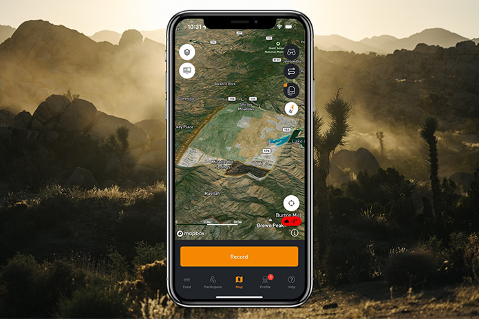
If you?re a fan of Rider?s touring stories, you?ve likely noticed that we have been using REVER maps to accompany the stories. The REVER app, available for free on iOS and Android, works in conjunction with the REVER website to help riders discover the world?s best roads, create custom routes, track epic rides, compete for bragging rights, and share riding experiences across social platforms. Recently, the company has upped its game with the ability to import georeferenced PDF maps into the app. These maps have embedded GPS boundaries that overlay on any existing map style and display your current location. For more information, read the press release below.
See all of Rider?s touring stories here.
EAGLE, Colo. ? REVER, the world?s largest motorcycle ride-planning, tracking, and sharing app, has introduced new capabilities to import and view georeferenced PDF maps in their Android and iOS apps. Georeferenced PDF Maps have embedded GPS boundaries that, when viewed in REVER, overlay on any existing map style and accurately display your current location. This allows access to detailed government maps and maps from other trusted sources ? including trail details, topographical lines, and geographic features not found in traditional map styles. In addition, PDF Map Layers are stored on your phone and are available anywhere in the world without cell service. Yet another way to never get lost!
Related: Justin Bradshaw, REVER | Ep. 63 Rider Magazine Insider Podcast
...
| -------------------------------- |
|
|
2025 BMW M 1000 RR, S 1000 RR, M 1000 R, and S 1000 R Preview
31-10-2024 07:22 - (
motorcycle )


